
Monitor and Manage Your Open Plot Online
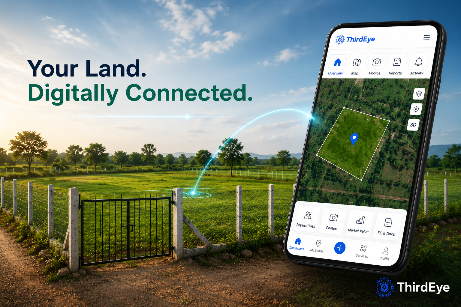
Keep an eye on your open plot from anywhere. Get regular physical visit updates, latest photos, and important land information—all in your ThirdEye account.
THE REALITY
Owning Open Land Should
Not Be Stressful
Encroachment Risks
Unauthorized occupation of your land can happen without warning.
No Regular Updates
You have no visibility into what is happening on your property.
Legal Confusion
Documents and approvals are often unclear.
No Supervision
No trusted person to oversee your property.
WHAT THIRDEYE DOES
Your Digital Property
Control Center
- Remote monitoring via satellite and partner visits
- On-ground site visits and photo documentation
- Fencing and physical security services
- EC documentation and legal record management
- Future-ready planning and layout visualization
PROCESS
Three Steps to Full Control
01
Open thirdeye.app
Access from any browser.
02
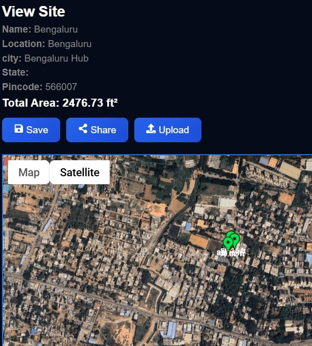
Add My Plot – Free (1 min)
Enter land details and pin location.
03
Request Services
Choose monitoring, fencing, legal.
SERVICES
Everything Your Land Needs
Fencing and Security
Physical boundary protection and security measures for your open land.
Live Monitoring
Partner-assisted site visits with photo and status reports.
Legal Services
EC certificate management, document verification, and ownership records.
Planning and Layout
Visualize future development, plot divisions, and construction planning.
MAP MY LAND
See Your Land From Above
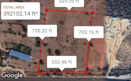
- Boundary mapping with precise coordinates
- Satellite overlay with terrain visualization
- Layout planning and plot division tools
- Future development simulation
WHY THIRDEYE
Built for Landowners Who Demand Transparency
India Focussed
Designed specifically for landowners in India with local expertise.
Verified Partners
All on-ground visits conducted by vetted, trained field partners.
Transparent Process
Every action is logged and visible in your dashboard.
Digital Tracking
Full audit trail of services, visits, and documentation.
FAQ
Common Questions
Everything you need to know about thirdeye, our services, and
the land reward
ThirdEye Monitor acts as your digital eye on your land. It helps you track, monitor, and stay updated on your property remotely through maps, reports, and periodic updates.
No, you don’t need to install anything. Our platform works directly in your browser, so you can access it anytime, anywhere.
Simply go to the dashboard, click on “Add Site,” and enter your plot details or mark the location on the map to start monitoring.
Yes, ThirdEye offers a free plan to get started. You can begin monitoring your plot at no cost, with optional paid features available for advanced services.
ThirdEye monitor can be used to monitor various types of plots and lands, including agricultural, residential, and commercial properties.
Satellite mapping provides a bird's-eye view of your property, showing changes over time and helping you stay informed about any developments.
During a physical visit, our team inspects your plot on-site, captures real-time photos, verifies boundaries (where applicable), and uploads a detailed update to your ThirdEye account
Yes, ThirdEye can assist by providing accurate plot mapping, layout visualization, and documentation support that can help during the LRS process. We can also guide you on required steps and data preparation.
Earn as You Monitor
The LAND reward ecosystem rewards active landowners. Earn rewards by registering your site, requesting services, and referring other landowners to the platform.
Register a Site
Earn rewards on every new site you add.
Request Services
Rewards on qualifying service orders.
Refer Landowners
Earn referral rewards for each verified signup.
Take Control of Your
Property Today
Join landowners across Telangana who are monitoring and securing their open land with ThirdEye.
Thirdeye is a property‑tech platform that bridges physical real estate with the possibilities of digital ownership. Our mission is to democratise property investment through transparent transactions and advanced tools such as AR/VR visualisations. We strive to empower owners with fractional ownership options while maintaining compliance and investor protections.